FEMA to update Lunenburg’s flood insurance rate map
Published 8:00 am Sunday, March 31, 2024
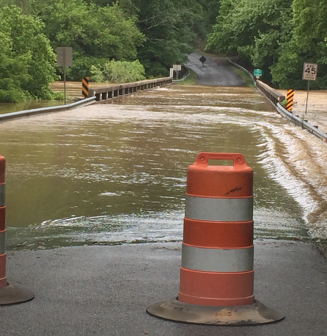
- Pictured is flooding at Route 363 at Whittles Mill on the Lunenburg/Mecklenburg county line.
|
Getting your Trinity Audio player ready...
|
FEMA is proposing updates to the Flood Insurance Rate Map (FIRM) for Lunenburg County and with that, community members are invited to participate in a 90-day appeal and comment period.
According to a FEMA spokesperson, flood maps are one tool communities use to know which areas have the highest risk of flooding.
FEMA maintains and updates data through flood maps and risk assessments.
“Flood risk changes over time. Water flows can change due to weather patterns like increased rainfall or land development. Updating the flood maps in Lunenburg County is important so that all the people who live and work here have good information about their risk of flooding. New maps can help people make smart decisions ahead of a disaster to protect their homes and properties for the future.” officials from FEMA media relations said.
FEMA representatives said the updated maps were produced in coordination with local and state officials.
“Significant community review of the maps has already taken place, but before the maps become final, community partners can identify any corrections or questions about the information provided and submit appeals or comments,” they said in a statement.
The 90-day appeal period began on or around March 13.
Reviewing flood insurance rate map
Residents, business owners and other community partners are encouraged to review the updated maps to learn about local flood risks and potential future flood insurance requirements. They may submit an appeal if they perceive that the modeling or data used to create the map is technically or scientifically incorrect.
An appeal must include technical information, such as hydraulic or hydrologic data, to support the claim.
Appeals cannot be based on the effects of proposed projects or projects started after the study is in progress.
If property owners see incorrect information that does not change the flood hazard information — such as a missing or misspelled road name in the Special Flood Hazard Area or an incorrect corporate boundary — they can submit a written comment.
The next step in the mapping process is the resolution of all comments and appeals. Once resolved, FEMA will notify communities of the effective date of the final maps.
Here in Lunenburg, County Administrator Tracy Gee is the floodplain administrator. Any appeals or comments go straight through her at tgee@lunenburgva.gov.
The preliminary flood insurance rate map may be viewed online by clicking here.